Berchtesgadener Land Local destinations, sights and Places to visit
The extreme south east of Germany, Bavarian district of Berchtesgaden forms the border with Austria.
Tthe landscape is shaped through the Bavarian Alps with the Watzmann massif. Whose peak is 2713m above sea level. NN and therefore represents the highest point of Berchtesgaden offers it represents a particularly rich flora and fauna and numerous hiking trails invite you to relax in nature.
Other attractions for nature lovers, the Schellenberger Ice Cave in the lower mountain, and the historic Eagle's Nest, from which you can enjoy in good weather excursion a panoramic view.
In the summer include hiking, mountaineering and mountain biking to the top activities in the Berchtesgaden area. A visit to the climbing center in whole or in the ropes in Berchtesgaden - Unterau are active for as interesting as a trip to the Wimbachklamm or at the Königssee. This is considered one of the cleanest lakes in Germany. During a boat trip across the lake Königssee, the baroque chapel of St. Bartholomew be visited on the peninsula Hirschau. South of the neighboring, smaller upper lake is a popular destination: the Röthbachfall - Germany's highest waterfall.
In the winter months the Berchtesgaden attracts with its six ski areas to visitors. Winter hiking on cleared trails, cross country skiing, curling and tobogganing on natural slopes are alternative excursions to snowy Berchtesgaden. The RupertusTherme in Bad Reichenhall and Berchtesgaden Watzmanntherme trippers offer rest and relaxation.
Worthwhile, and not just among motorcyclists is a popular destination, is the Roßfeld Panorama Road. Germany's highest, toll road every season offers great views of the Berchtesgaden Alps, and the Salzach, the Tennen and Hagen mountains and Lattengebirge.
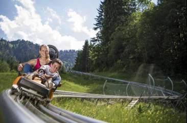
With the fairy tale path Bischofswiesen, the Lokwelt Freilassing and the summer toboggan run on the Obersalzberg, the holiday region Berchtesgaden has to offer several attractions for children.
Details
21553 Visitors
Details
20279 Visitors
Details
12967 Visitors
Details
12232 Visitors
Details
13485 Visitors- Old Salt Works Bad Reichenhall
- Suitable for kids
- Parking lots available
- Indoor
DE - 83435 Bad Reichenhall
Details
12944 Visitors
Details
8815 Visitors
Details
13821 Visitors
Details
10477 Visitors
Details
12582 Visitors
Details
19274 Visitors
Details
11232 Visitors
Details
10485 Visitors
Details
17160 Visitors
Details
11504 Visitors
Details
8884 Visitors
Details
8382 Visitors
Details
8273 Visitors
Details
7870 Visitors


_koenigssee/001.jpg)


_koenigssee/001.jpg)


_obersee/001.jpg)


_roethbachfall/001.jpg)


